A coalition of more than 300 military and government officials, community leaders, conservationists, scientists, fishermen, and others recently released a plan to save the future of a million-acre expanse of salt marsh stretching from North Carolina to east-central Florida–nearly the size of Grand Canyon National Park.
The South Atlantic Salt Marsh Initiative’s plan, roughly two years in the making, calls for protecting the sinewy channels of coastal grasslands for their value in reducing flooding and erosion while providing wildlife habitat important for recreational and commercial fishing, hunting, birding, eco-tourism and other activities that support coastal businesses and economies.
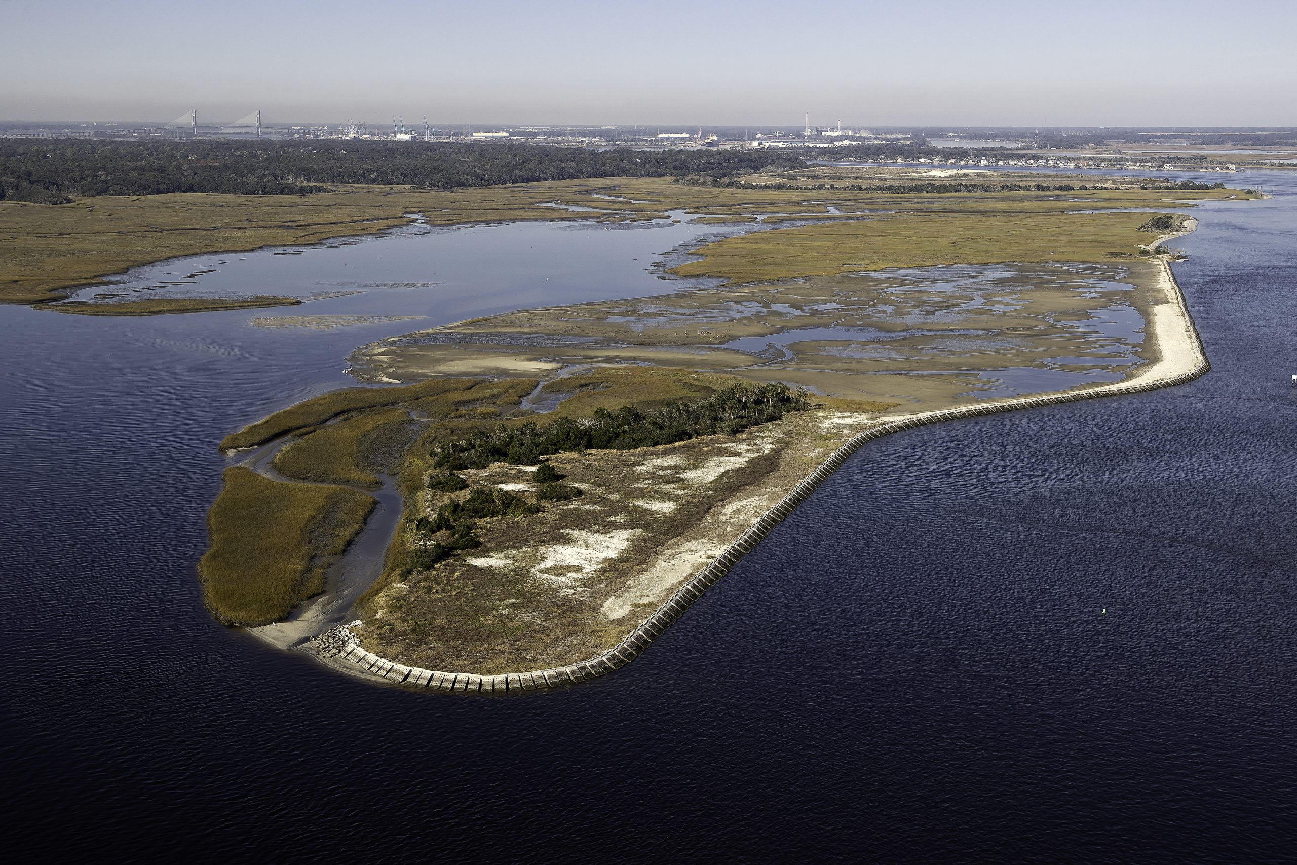
Great Marsh Island, Florida, was restored as part of efforts to address severe erosion and nearby navigation concerns. Photo by Mark Bias.
The plan lays out key strategies, objectives and actions ranging from elevating roads to conserving land near marshes so the tidal wetlands can move as sea levels rise. (Please see the executive summary for a full list.) The marshes are threatened by rising seas, polluted runoff and unsustainable development. The voluntary plan calls for close collaboration between SASMI partners, local communities and governments to identify and implement the tactics best suited for each location. And it includes suggestions for securing funding, improving development planning processes and educating and engaging communities in the co-creation of salt marsh conservation projects.
The coalition was brought together by The Pew Charitable Trusts and the Southeast Regional Partnership for Planning and Sustainability (SERPPAS), whose members include the U.S. Department of Defense and other federal agencies along with state environmental and natural resource officials from across the Southeast. The Defense Department hosts more than a dozen installations on or near the Southeast coast and some, such as Parris Island Marine Corps Recruit Depot in South Carolina, already are experiencing flooding and other effects of rising seas.
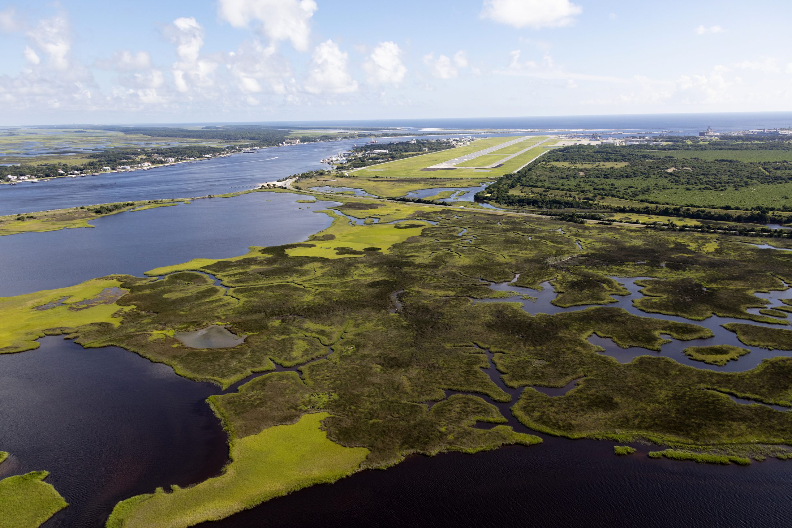
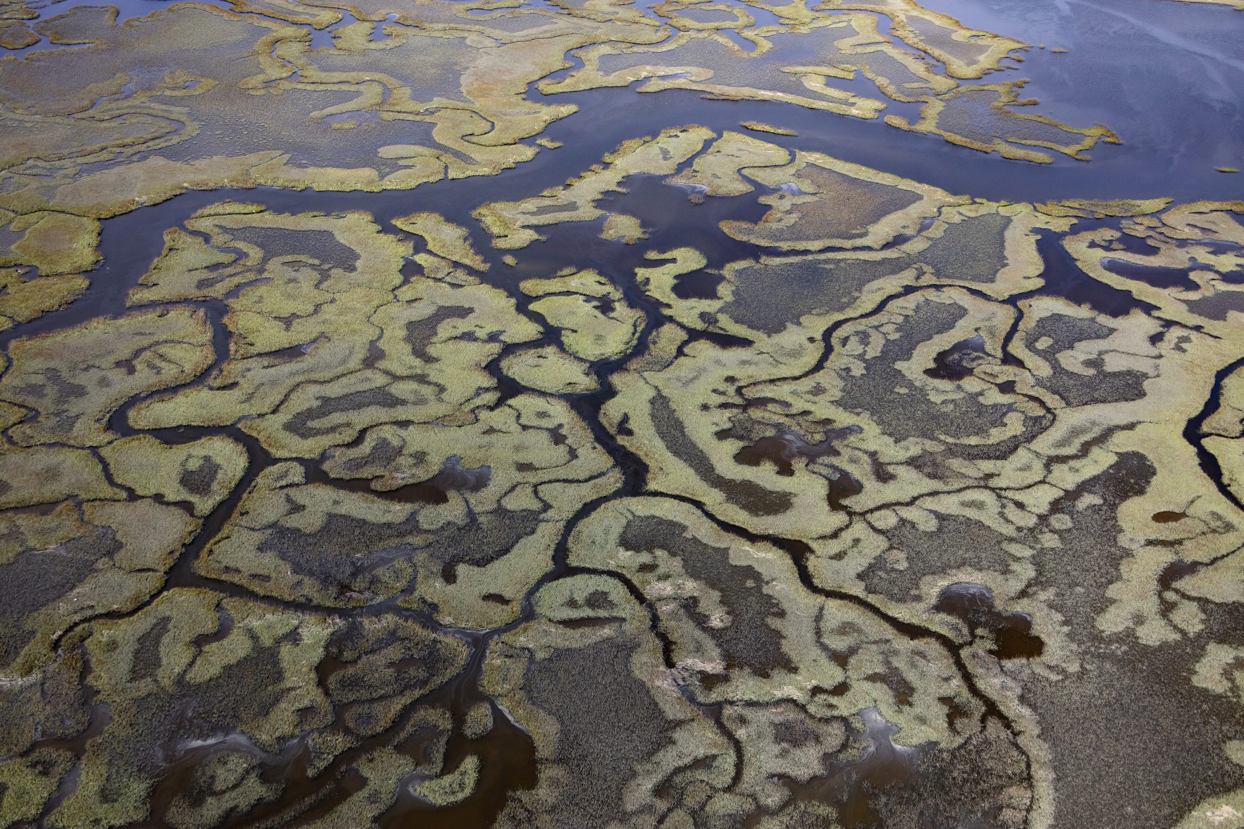
An aerial view shows salt marsh adjacent to the runway at Naval Station Mayport in Jacksonville, Florida. Photo by Mark Bias.
“The Department of Defense relies on healthy, functioning ecosystems to support our mission readiness. But these ecosystems and the services they provide are changing rapidly, and no entity, area or activity is going to be immune to effects of these changes,” said Richard Kidd, SERPPAS principals co-chair and Deputy Assistant Secretary of Defense for Environment and Energy Resilience. “Specifically, for military installations along the coasts the DoD is concerned about saltwater intrusion, sea level rise, and storm surge. As the sea advances, and salt marshes migrate it compresses existing infrastructure and encroaches on our installations. So we need to not only preserve salt marsh to serve as a buffer for our installations, but also ensure that migration can occur without conflicting other land uses. We know it’s going to take cooperation and partnerships to address these issues, and this conservation plan is a significant step toward planning for the future.”
The South Atlantic coast also is home to millions of coastal residents, including the Gullah/Geechee Nation — descendants of enslaved Africans and indigenous Americans who are intimately linked to the salt marsh. Chieftess Queen Quet, who works to protect the sacred lands and waterways of her people, served on the initiative’s steering committee because she recognizes the value of salt marshes to the sustainability of her homeland, for food security and Gullah/Geechee spiritual practices.
The initiative will work with its partners throughout the region to implement the plan. Initial meetings will be scheduled in each state in coming months to discuss the plan and develop next steps.
The Nassau River–St. Johns River Marshes Aquatic Preserve in northeast Florida is among the many areas whose managers work to monitor, research, and protect salt marsh and associated habitats. Photo by Mark Bias.
Background About Salt Marshes
- The marshes provide an estimated $7,284 per acre, annually, in protective value from storm surge and flooding alone.
- 14% to 34% of existing salt marshes along the South Atlantic could be lost by 2060 if seas continue to rise as expected, according to the National Oceanic and Atmospheric Administration (https://pulitzercenter.org/stories/million-acres-priceless-marshes-protect-nc-sc-ga-will-they-perish-rising-tides).
- The U.S. has approximately 3.8 million acres of salt marshes including a vast interconnected 1 million-acre stretch from North Carolina to Florida.
- Salt marshes, and the estuaries that support them, provide shelter, food, and nursery grounds for more than 75% of commercial and recreational fish species in the country, including white shrimp, blue crab, redfish, and flounder (https://oceanservice.noaa.gov/facts/saltmarsh.html).
- During storms, salt marshes absorb flood waters and wave energy, decreasing property damage in adjacent communities by up to 20%, according to NOAA (https://www.fisheries.noaa.gov/infographic/infographic-value-coastal-wetland-habitat).
- One acre of salt marsh can absorb up to 1.5 million gallons of floodwater, which is equivalent to more than 2.25 Olympic-size swimming pools (https://www.fisheries.noaa.gov/infographic/infographic-value-coastal-wetland-habitat).
- By filtering runoff and excess nutrients, salt marshes help maintain water quality in coastal bays, sounds, and estuaries.
- Salt marshes provide important habitat for a variety of birds, including popular waterfowl and imperiled species such as the Eastern black rail and saltmarsh sparrow.
- Salt marshes get their salt from the seawater that comes in with the tides. They are marshy because their ground is composed of fine, muddy sediment and decomposing plant matter known as peat.
- Salt marshes and coastal wetlands sequester and store carbon at a rate 10 times that of mature tropical forests, helping to moderate the effects of climate change (https://oceanservice.noaa.gov/ecosystems/coastal-blue-carbon/).
- Also known as tidal wetlands, salt marshes are one part of a complex coastal ecosystem with interdependent habitats. For example, by filtering pollutants, marshes help oyster reefs and seagrass beds, which need clean water to survive. But as salt marshes degrade, the health of adjacent coastal habitats and marine life suffers.